
When you think of Michigan, your mind most likely wanders to the mitten-shaped state just north of Indiana, also known as the Lower Peninsula. You may think of things like cherries, sand dunes, or Motown. But what sits on top of Michigan’s “mitten” contains some of the most beautiful landscapes, waterfalls, mountains, and outdoor adventure hotspots. That’s right, I’m referring to the Upper Peninsula. This 16,377 square-mile piece of land that is separated by Lakes Michigan and Huron is packed full of terrains to admire and adventures to embark, no matter the season. Whether you want to paddle, fish, or jet one of the three bordering Great Lakes, hop on a ferry to visit an island, view the Northern Lights, lounge on a beach, summit a mountain, snowmobile down unpaved backroads, axe your way through an ice cave, or chase waterfalls, head on up to the UP!
Up until this summer, I had basically skirted the UP, having crossed the Mackinac Bridge a handful of times to access the US/Canadian Border, passed signs for Tahquammenon Falls, and walked around the streets of Mackinaw City. But it wasn’t until a few weeks ago that I officially explored half of the Upper Peninsula of Michigan.
Our original plan had been to explore the entire Peninsula, camping in state parks, hiking miles of trails, and stopping at different highlights as we made our way east. But as you all know, our world has looked drastically different lately than it did late last year when we began planning our road trip. We had planned to drive north through Wisconsin, stop at Copper Falls, and then make our way into the UP, exploring the Porcupine Mountains, Isle Royale National Park, Kitch-iti-Kipi, Pictured Rocks, Tahquamemmon Falls, and Mackinac Island. Due to campground and national park ferry closures, we were forced to alter our plans. Optimistic and determined, we quickly edited our route and booked an Air B and B. Our full UP adventure switched to an “Eastern Side” exploration, and we most certainly weren’t disappointed. We filled our week with hiking, paddling, and chasing waterfalls!
The changes that we had to make to our original plan actually allowed us to spend more time at each place, and even add spots along the way. Our accommodations resided in the central town of Germfask, which was less around an hour from all of our destinations (in different directions) : Pictured Rocks, Tahquammeon Falls, Mackinac City, Kitch-iti-Kipi, and Presque Isle. This central location allowed us to spend more time exploring and less time driving.
Whenever we embark on an adventure, we always have a plan, but we are flexible to make changes along the way. Being prepared is less stressful and allows room for sudden spontaneity, when desired. That being said, our “revised” Eastern UP Trip was revised once again when we spontaneously decided to visit another park and hike some new trails. Flexibility and preparedness are a great combo when road-tripping!
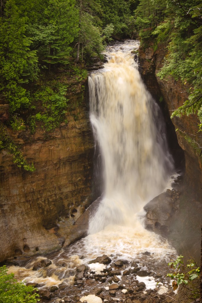
TAHQUAMMEMON FALLS
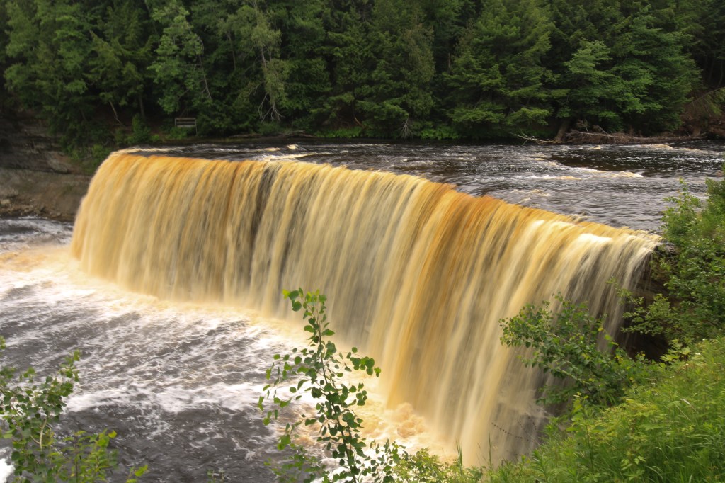
Driving up north from lower Michigan, our trip began at Tahquammemon Falls State Park. A four-mile hike will take you from Upper Falls downstream to Lower Falls, or, if you’re in a time crunch or brought along tiny kiddos, you can take the short, easy walk to each of the falls from two designated parking areas. Upper Falls (pictured above) is the most popular and arguably the most impressive waterfall in Michigan. Its sheer volume makes it the largest waterfall in Michigan and one of the largest waterfalls east of the Mississippi. With its 50 foot drop, 200 foot width, and its staggering flow of 50,000 gallons per second, Upper Falls sure doesn’t disappoint.
Though Lower Falls may be smaller than its sister falls, it shouldn’t be overlooked or underestimated. While Upper Falls has one massive cascade flowing off of a rocky cliff, Lower Falls has a series of five staggering cascades. The Tahquammemon River, which flows through the waterfalls and between tall, lush trees, is the perfect spot for kayaking or canoeing. Rentals are available in the area if you don’t have your own!
KITCH-ITI-KIPI “BIG SPRINGS”
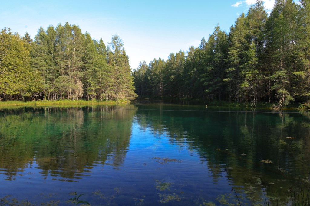
Our second stop was Kitch-iti-Kipi, also known as “Big Springs.” This gem sparkles in the town of Mantistique and is tucked into Palms Book State Park. This spring, which is the largest freshwater spring in all of Michigan, appears as though it was snatched right out of central Florida, with its vibrant, crystal-clear, emerald water. Evergreen trees frame the edges, perfectly reflecting along the water’s smooth surface. A self-guided observation raft, operated by a cable system, allowed us to explore the length of the springs and obtain close views of the underwater gems, including clustered, fallen tree trunks, ancient, mineral-encrusted branches, and colorful fish of all shapes and sizes. A kaleidoscope of shapes flashed through the springs as the sandy bottom shifted with the ever-gushing water, allowing imaginations to wander to dreamlike states. A variety of trout and even the occasional yellow perch swam at all depths, their shimmering gills reflecting off the sun rays and bouncing back on the glassy, mirrored surface.
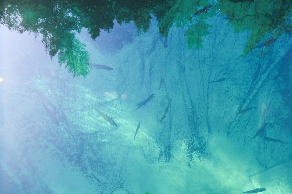
I felt hypnotized by the vibrant colors, impeccable reflections, and schools of fish swimming effortlessly through the crystal spring. The water was so clear that you could see all the way to its sandy bottom, which appeared quite a bit deeper than its true, 40-foot depth. Its constant, 45-degree temperature ensures that the water will never freeze, and therefore can be explored any time of year! It is the perfect addition to your Upper Peninsula adventure, and you will need no more than an hour to explore every inch of the park and peruse the gift shop.
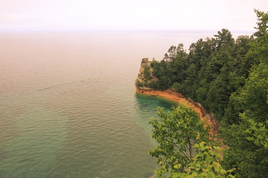
PICTURED ROCKS NATIONAL LAKESHORE
Pictured Rocks was the spot that captured my attention from the beginning. These massive, colorful cliff lines that were splashed across blogs, highlighted on Instagram stories, and pinned to Pinterest boards were the reason I began planning an Upper Peninsula road trip. I just had to see this magnificent shoreline in person!
I recently published a blog post about our paddling adventures in Lake Superior along the Pictured Rocks cliffs, so in this blog I’d like to focus on the waterfalls, trails, and beaches across this national lakeshore.
WATERFALLS
There are more than 300 waterfalls scattered across Michigan’s Upper Peninsula. Some are tall, narrow and calm; others are short, vast, and thunderous. Some trickle; others roar. Some fall off cliffs and are only visible at water level; others require strenuous, 10-mile hikes along the lakeshore to access. Winter brings frozen ice walls and frosted evergreens; summer brings flowing stunners with lush foliage. No matter how much time you have, no matter your physical strength, and no matter where and when you can view these gems, there is a waterfall for you!
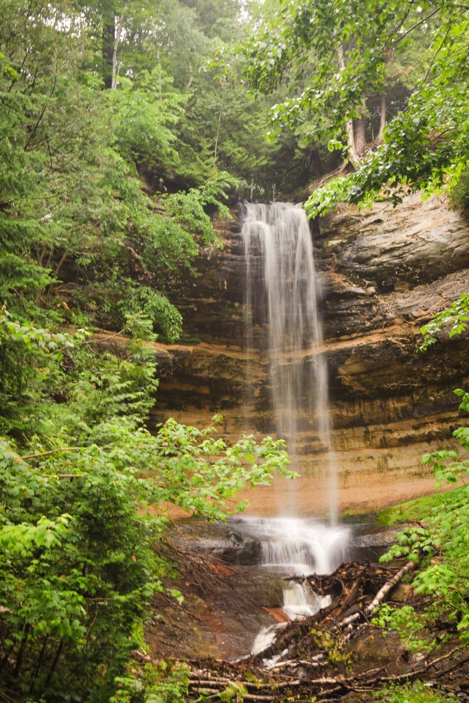
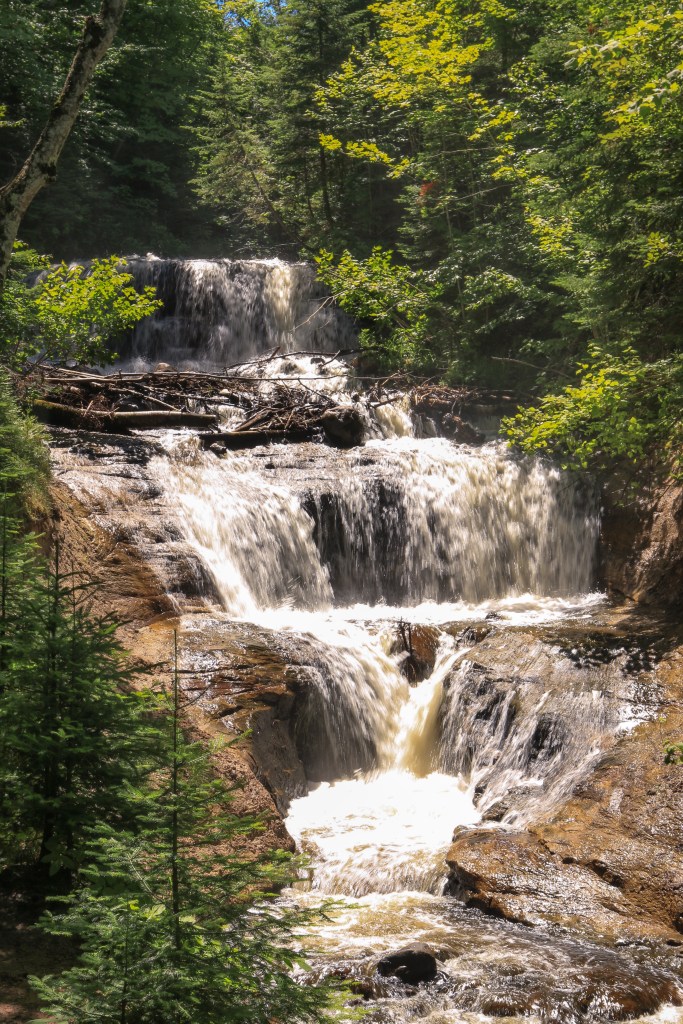
Three waterfalls that only require a short hike are Munising Falls, Miners Falls, and Sable Falls. All of these are accessible by parking lot trailheads. Miners Falls is a little over a mile; the other two are even shorter.
Miners Falls is a 1.2-mile out and back trail, winding through a thick forest. There is a set of steep stairs to get down to the viewing area; there is not a designated path to the gorge, so just admire the falls from the balcony. Miners Falls rests inside a sandstone outcropping and drops 40 feet. Its roaring waters can be heard at least a half-mile before it is in view; rocky cascades give way to a tumbling fall off a massive cliff before crashing into a rocky pool below.
Munising Falls is only 0.4 miles roundtrip, and since we arrived just after sunrise, we were the only two when we arrived at the falls! This easy trail wound along a stream and ended up at a beautiful sandstone outcropping with a quiet, peaceful waterfall cascading 50 feet off a cliff. Instead of its waters collecting in a pool below, it cascaded down a series of rocks before spilling into a long, skinny stream back down the trail.
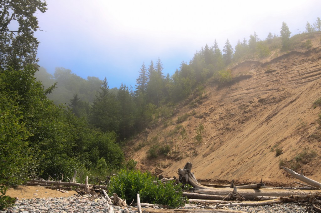
Sable Falls was a last-minute decision. As we were driving east along the lakeshore, our eyes peeled for spots to stop, we decided to go all the way to the end around the Grand Marais area. Trails to Grand Sable Dunes and Sable Falls were intertwined. A beautiful, cascading waterfall was located about a half mile into the trail and flowed downstream all the way into Lake Superior. The trail spilled out into a secluded, rocky beach with towering sand dunes lurking behind and the vast waters of Lake Superior ahead. Tip-toeing through the rocks, we explored the foggy beach and admired the fact that we had stumbled upon such a beautiful place!
HIKING TRAILS
Aside from the waterfall trails that I mentioned above, we hiked many other beautiful paths along Pictured Rocks National Lakeshore. The trails featured stunning wooded oases, impressive lake views, and towering sand dunes. For backpackers, a 40-mile trail snakes along the entire lakeshore. Beaches, dunes, waterfalls and unique rock formations will be your backdrop on this multi-day trip. For day hikers, here are some hikes that I’d recommend:
Grand Sable Dunes Loop: This easy loop intersects with Sable Falls trail. After viewing an impressive 75-foot cascade, you will continue downstream until you reach a “secret” opening to a secluded beach. This rocky beach is part of the Sable Beach; dunes tower behind you and Lake Superior stretches in front of you, welcoming you into its vast arms.
Miners Castle Trail: This paved trail takes you to an overlook with sweeping views of Pictured Rocks, specifically Miners Castle. One turret on the castle remains after a rockfall in 2006 caused the other one to collapse and fall into the lake. (Other major rockfalls have occurred on Pictured Rocks and are not uncommon to the lakeshore. Rockfalls typically occur in the spring after the cliffs have thawed.)
Log Slide Overlook: This trail leads you to steep sand dunes that can be climbed to the top to view Lake Superior. Adventurer seekers can take the “log slide” challenge by running 500 feet down the vertical dunes toward the water and climb back up again. (Don’t underestimate this challenge; keep hydrated because it will take you over an hour to climb back up!) The day that we visited the overlook, Lake Michigan was completely obstructed by dense layers of fog, so this “log slide” challenge contained an extra dose of heart-pounding excitement as hikers appeared to be running into the abyss, completely vanished from view. (We gathered from photos that Lake Michigan was just beyond the dunes, but from the vantage point, all you saw was haze.)
BEACHES
Miles of impressive beaches line the lakeshore. From Sand Point to Sable and everywhere in between, there isn’t a bad stretch of sand to lay a towel, soak up sunshine, and cool off in the lake. Here are some of my favorite beaches from the trip:
Sand Point Beach: If you decide to start your UP adventures in Munising and head east toward Grand Marais, the first beach that you will reach will be Sand Point. This beach, which was named one of the “Top Five Summer Beaches in America,” in 2007 was quite quiet in the early morning hours, but I’ve read that it becomes pretty touristy in the afternoon hours of the summer. What makes this beach unique are the underwater sand dunes that lay at the lake bottom. The sand dunes that you see towering behind you along the lakeshore continue underwater at this beach. Some dunes are hundreds of feet high as you go deeper into Lake Superior around Sand Point! Sand is known to be quite fragile, but it has miraculously kept its structure underwater, much like it does above water. Both wind and water constantly cause the dunes to shift its shape, which is why the dune heights may be slightly different each time you visit. Take a peak below the water’s surface when you visit this beach and observe the beautiful underwater world that is constantly changing! Walk into the water and feel your feet sink into the sand and watch your toes disappear underneath.
Mosquito Beach: A trail will lead you to this beach, or you can access it by water, which is what we did. We kayaked from Miners Beach to Mosquito Beach, where we ate lunch with our tour group. This rocky beach is quite impressive, with stunning views of the cliffs and Arch Rock towering to the left. Make sure to wear sandals as the beach is all rock, in and out of the water; it can get very slippery.
Sable Beach: This is the beach that I mentioned above. The Sable Falls and Grand Sable Dunes trails will drop you off at this secluded beach with dunes to climb, rocks to hop, log obstacles to traverse, and plenty of open water to swim.
Twelvemile Beach: This beach, as you may have guessed, is twelve miles long. There are many access points along the highway. The one that we accessed was completed secluded. While we ate our lunch on this beach, we were the only two in sight for miles on each side. It truly felt as though we were in a Caribbean slice of paradise!
Miners Castle Beach: This is the beach that we used as a launch site for our kayaking excursion. Though we didn’t stay on this beach for long, I am adding it to this list because it only takes a short, quarter-mile walk to get to the beach from the parking lot; and the Pictured Rocks cliffs are towering on both sides, making it a picturesque spot to picnic or swim.
Presque Isle
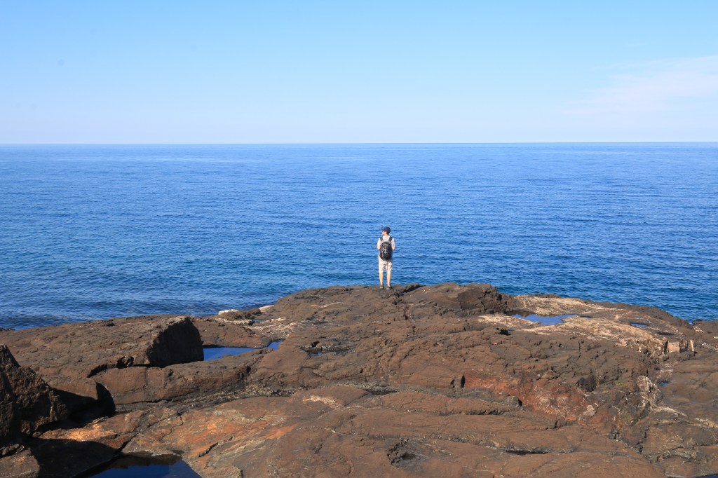
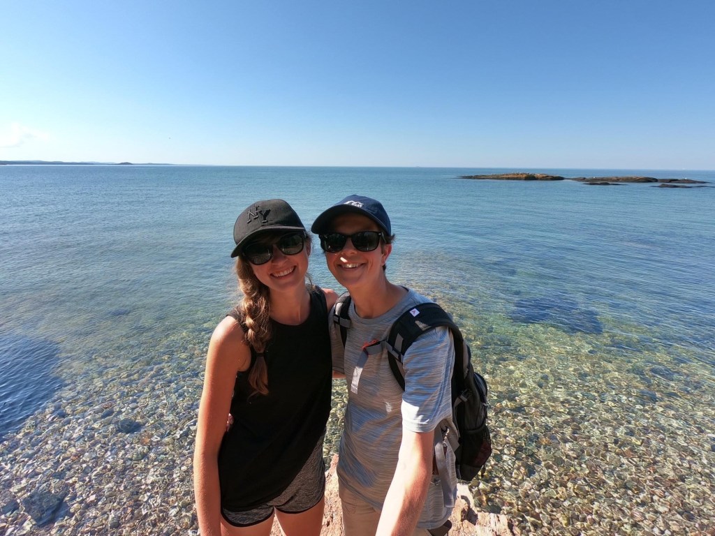
While riding the shuttle bus to Miners Beach, where we would launch our kayaks at Pictured Rocks, we met some interesting people from all over the country. One middle-aged guy, who was from Michigan himself, was extra chatty with us. He shared information on many of the places that he’d visited, including the best highlights of Michigan. He seemed particularly excited about a spot in central UP called Presque Isle Park. As he continued to rattle off other places and sights worth seeing, I quietly filed that name in the forefront of my mind, knowing that we’d have to hit up that spot before we left. I had remembered reading about this particular place, as it was mentioned in many of the UP road-tripping articles that I thoroughly scoured, but I hadn’t been sure if we’d have time for it. But sure enough, on the eve of our last day in the UP, we embarked even farther west to explore Presque Isle.
Located in Marquette, Presque Isle Park is a forested peninsula jutting into Lake Superior with unbeatable views. With many spots to pull over and park your car, you can explore the rocky cliffs, swim in the mini rocky beaches that scatter the cliff lines, or bravely cliff dive into the vibrant blue waters a hundred feet below.
Though this park was packed, it wasn’t hard to find solitude. We parked our car along the cliffs and meandered our way through the rock scrambles and overhanging cliffs. The views of the sandstone bluffs, etched coves, rocky islands, and the choppy waters of Lake Superior were unmatched. We spotted a secluded rock that protruded over the water, and with our feet dangling from the edge, we enjoyed our dinner and basked in the glory of our spontaneous decision.
We watched all of the action surrounding us as we ate. Speed boats sliced through the water, causing massive waves to ripple gradually before crashing against the cliffs below our feet. Paddle-boarders and kayakers hugged the cliff line as they dipped their paddles into the water. A jet-skier with a dog on board whizzed by, the puppy’s floppy ears blowing in the breeze. Kids with colorful kayaks that were hoisted ashore on an island fed squawking seagulls. Tourists snapped selfies while splashing each other playfully with water. We were mesmerized by all of the sights that by the time we finished eating, we were beyond eager to explore the area ourselves.
We rock climbed, watched cliff divers catapult off rocks and into the deep water below, hiked through quiet trails that zigzagged through thin forests, and admired the unending, grand beauty of Lake Superior.
This spontaneous visit was definitely well worth the trip, and I’d highly recommend adding it yours as well!
Mackinac Island
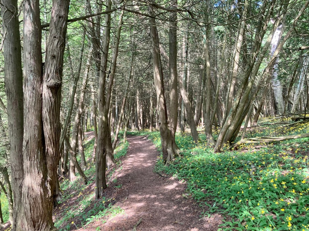
Even if you don’t live in this Midwest, you’ve surely heard of Mackinac Island. This tiny but bustling island sits almost eight miles from the Mackinaw City harbor. The island contains the only highway in the United States to ban motor vehicles, also making it the only highway with zero automobile accidents. Free of exhaust, road rage, and honking horns, you can make your way around the island on foot, bike, or horse-drawn carriage. Mackinac Island State Park covers most of the four square-mile island, with plenty of serene hiking trails, a limestone natural arch, fine dining, touristy shops, and the famous Grand Hotel.
Other than the automobile policy, Mackinac Island is famous for its irresistible, rich fudge! There are several shops that sell these delicacies, such as Joann’s Fudge and Murdick’s Fudge, that all reside on the main strip facing the docks. Make sure to pop in one or two of these shops, do some taste testing, and purchase some delicious flavors of Mackinac fudge!
We spent most of our time wandering around the island and dipping our toes into the water when it became sweltering hot. As I mentioned before, Mackinac Island State Park covers most of the island, so there were plenty of places to step away from the crowds and enter some cool, quiet wooded trails. Part of the allure of this state park is its famous natural arch that frames Lake Huron, Arch Rock. A section of the highway that runs underneath the arch was closed for construction, so we weren’t able to view it from below; but we did see it from the top! A thick fog hovered over the lake, making it appear as though we were staring into the abyss.
The ferry that hauled us to and from the island took us on a detour under the Mackinac Bridge, which stretches five miles across Lake Huron. Check scheduled ferry times to see which hour you can take this detour; you won’t regret it! Having driven across the elongated bridge in a car and now having jetted underneath in a ferry was quite a neat experience. Come visit Mackinac and see for yourself!
Torch Lake
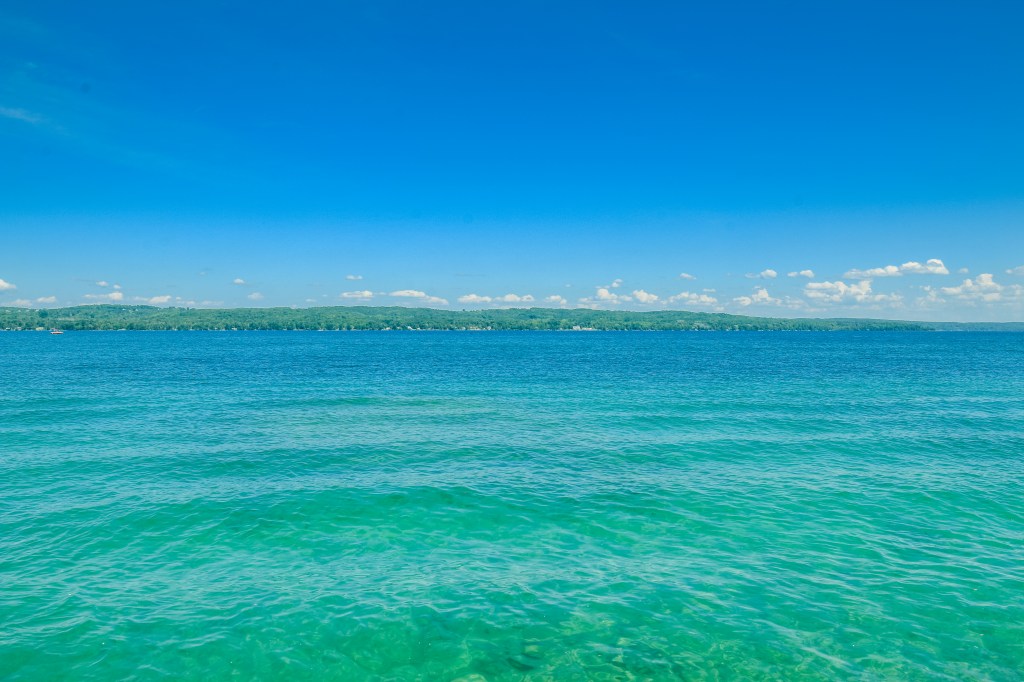
Torch Lake isn’t located in the Upper Peninsula, but it perfectly capped our vacation as we made our way home. About two and a half hours south of Mackinac Island, this lake is a touristy hotspot. Its reputation is quite prestigious; celebrities own property on this lake, and it is known to be the source of many sandbar parties and vacation getaways. Its clear turquoise waters have drawn visitors from all over the country to marvel at this Caribbean-esque lake. Though this gem is located in Northern Michigan, you will think that you have just stepped off a Caribbean cruise. Depending on the weather and sky color, the water is known to change from fiery gold to emerald green to deep turquoise.
National Geographic named this lake as the third most beautiful lake in the world. That’s right. The WORLD. And it’s right here in Michigan! I admit that I was a bit skeptical on just how clear and turquoise this water was going to be, but let me be the first to tell you, I’ve seen it in person and it IS exactly as you see it in photos.
Whether you want to snorkel, swim, fish, spend a lazy day at the beach, jet ski, paddle board, or windsurf, this lake is a perfect cap to your UP trip! Camping, hiking, biking and skydiving are some of the other activities that people can chose to do. Add that to the delicious food and cute small town charm in the surrounding area, it’s no wonder it attracts so many visitors each year.
The UP is one of my favorite places we’ve ever been, and it’s one of those places where you have to visit in different seasons. When we return, we plan on backpacking the Chapel Beach/Mosquito Beach/Grand Portal Point trails, snowshoeing to those magnificent ice caves in the winter, of course, explore the western half of the Peninsula!
Happy adventures!

wonderful pics!
LikeLike